You are hereHome >All Projects > L.L. Anderson Dam Spillway Modification
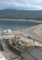
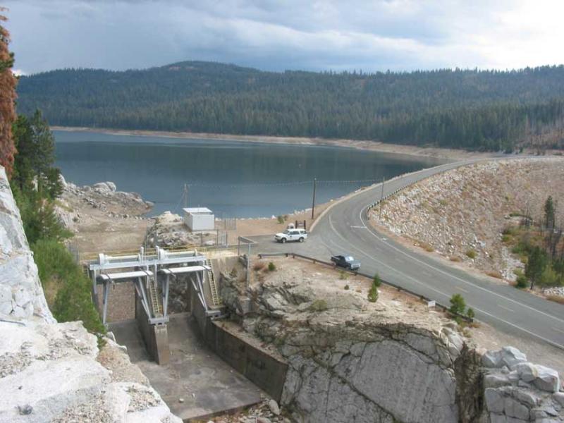
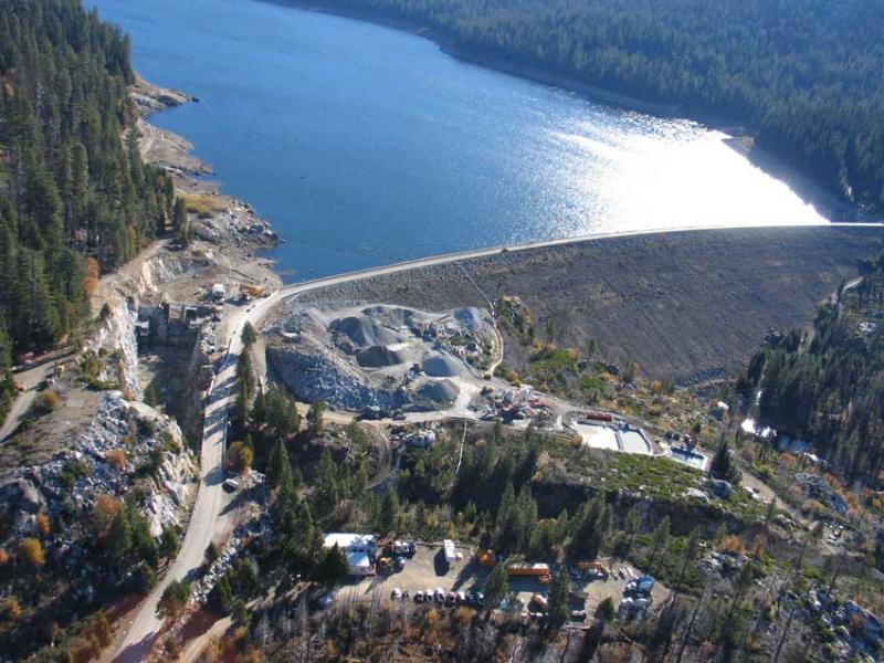
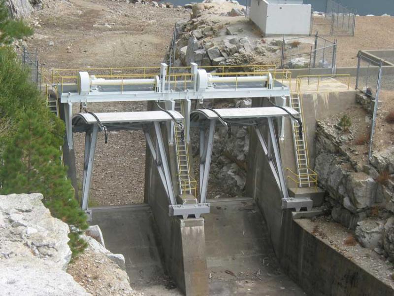
The 231-foot-high L.L. Anderson Dam (also known as the French Meadows Dam) is owned by the Placer County Water Agency (PCWA). The multi-purpose water supply and hydroelectric dam, originally constructed in 1966, diverts water from the Middle Fork American River watershed to the Rubicon River watershed to support power generation at a series of hydroelectric powerhouses, including the French Meadows Powerhouse. The LL Anderson dam spillway, located on the north (right) abutment of the dam, originally included a 48-foot-wide approach channel excavated in rock leading to a gated concrete ogee weir equipped with two 20-foot-wide by 18.5-foot-high radial gates.
Location: Placer County, California, United States
The original probable maximum flood (PMF) estimate at the dam was estimated to have a peak inflow of 29,300 cfs. Hydraulic calculations showed that routing the original PMF through the reservoir and spillway resulted in a peak discharge of 12,200 cfs. However, since construction of the dam, the PMF was updated several times since the 1980’s, including the latest PMF inflow estimate (2005) of 59,100 cfs. Hydraulic routing of the latest PMF indicated that the spillway did not have enough capacity and the dam would be overtopped by the flood, thus putting the dam at a high risk of failure under extreme flood conditions. In addition to posing great risk to people and property downstream, an assumed failure of L.L. Anderson Dam from flood overtopping would exacerbate the current need to upgrade spillway capacity at Folsom Dam, substantially increasing project costs at that project. Due to the significant risks to communities and users downstream, the project regulatory agency, the Federal Energy Regulatory Commission (FERC), mandated that PCWA address the spillway capacity deficiency at L.L. Anderson Dam using the updated PMF.
MWH began the design phase of the project with development of spillway modification concepts that were initially performed using industry standard equations and software packages, namely the HEC-1 and HEC-RAS software packages developed by U.S. Army Corps of Engineers (USACE). The HEC software was selected in order to develop feasible concepts that were later verified and refined by a 1:20 scale physical model, performed at the Utah Water Research Laboratory, one of few hydraulic laboratories equipped to construct a physical model of this size.
Based on results from the physical model studies, the project design required modification of the existing spillway only in its upper channel, upstream of the first 40-foot drop. Modifications included 14 to 30-feet of widening along the upper spillway channel, a new gate structure downstream of the existing structure, new gate controls and instrumentation that include provisions for future remote operation, a nominal dam raise, a parapet wall along the 2,700 foot dam crest, and site improvements to limit access and improve public safety. Construction of the L.L. Anderson Dam Spillway Modification Project started in April 2010 and was substantially completed in December 2011.
Geotechnical engineering
Geologic Mapping
Mechanical engineering
Structural engineering
Hydraulic analysis
Seismicity update
Spillway design
Civil design of dam raise
Preparation of plans, specifications, reports and findings
CADD maps, plates and drawings
Construction Management (MWH Constructors)
Construction technical support and quality control
Permitting support
Agency coordination
2011 Heavy Civil Construction Project of the Year by Sacramento chapter of the American Society of Civil Engineers (ASCE)
2012 Project of the Year in the $10 million to $50 million small agency division, in the structures category, from the Sacramento Chapter of the American Public Works Association (APWA)
MWH provided the hydraulic engineering expertise to focus and optimize spillway widening design efforts.
Expert structural and mechanical design experience provided an optimized spillway gate and gate structure design.
Geotechnical expertise provided an optimized rock slope stability and excavation design, which included eliminating benches in the massive granitic bedrock structure and utilizing cutting edge digital photogrammetry techniques to efficiently map and evaluate the spillway channel rock slopes.
Photos:
A view of the L.L. Anderson dam and spillway structure.
Aerial photo of the project featuring the spillway and French Meadows Reservoir.